
William Mayo’s Map of Richmond, 1737
Collections in the Classroom
Grade Level
Elementary, High, Middle, Pre-K
Time Period
1600-1775: Colonial
Theme
Community
Resource Type
Post-visit material, Pre-visit material, Primary Source
Download Collections in the Classroom: Mayo Map (pdf)
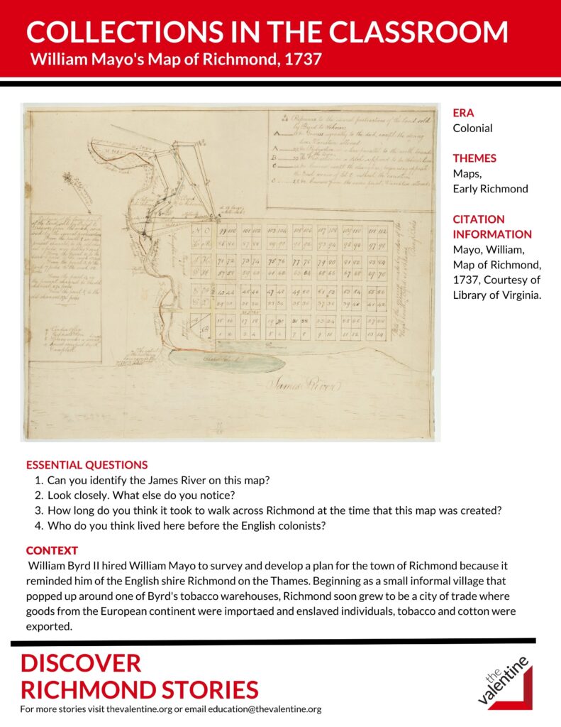
ESSENTIAL QUESTIONS
- Can you identify the James River on this map?
- Look closely. What else do you notice?
- How long do you think it took to walk across Richmond at the time that this map was created?
- Who do you think lived here before the English colonists?
CONTEXT
William Byrd II hired William Mayo to survey and develop a plan for the town of Richmond because it reminded him of the English shire Richmond on the Thames. Beginning as a small informal village that popped up around one of Byrd’s tobacco warehouses, Richmond soon grew to be a city of trade where goods from the European continent were imported and enslaved individuals, tobacco and cotton were exported.