Captain John Smith’s Map
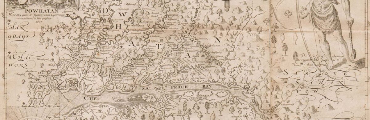
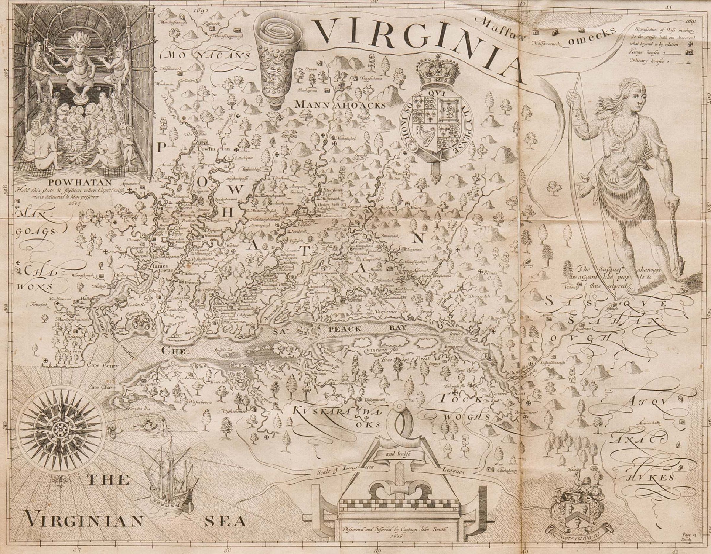
Take a look at Captain John Smith's map of the entire Chesapeake region from the early 1600s.
By Valentine Museum Staff
Based on an exploratory survey by boat in 1608 under the direction of Captain John Smith, this map is the earliest published of the entire Chesapeake region. It not only shows the location of Jamestown, the first English settlement in the New World, but also the location of numerous Indian villages. The map is oriented with west at the top, drawing attention to the approaching ships from England at the base.
To the right of the illustration of Chief Powhatan, “The Falls” of the James River are shown together with the hills, upon which the city of Richmond was later built. This is the earliest known engraving attempting a pictorial representation of the site of Richmond.
John Smith’s “Virginia” remained the most influential map of Virginia until the last quarter of the 17th century, and many of the place names used by Smith remain in use today.
Need to cite this?
| Authors | Valentine Museum Staff |
|---|---|
| Work Title | Captain John Smith’s Map |
| Website | https://thevalentine.org |
| Published | October 12, 2023 |
| Updated | November 17, 2023 |
| Copyright | © 2024 The Valentine Museum |